
 HEAVY RAIN, THUNDER, HAIL AND STRONG WINDS OVER THE NEXT 24 HOURS. Please LIKE and SHARE for others. Thanks.
A cold front associated with an intense low pressure system moving eastwards across Italy is expected to bring bad weather across the Maltese Islands over the next 24 hours.
For the Maltese Islands, this means strong Force 7 winds at times (gusting Force 8 to 9) from a northwesterly direction with rough seas of around 4 metres from a northwesterly direction tomorrow Tuesday (these are the maximum significant wave heights expected).
Rain showers that may be gusty, heavy, thundery and/or with hail at times are also expected over the next 24 hours. Any rain showers may cause brief localised flooding, with the heaviest rain expected mainly from 4am till 4pm tomorrow Tuesday. However, the weather will improve on Wednesday with partly cloudy skies and moderate winds.
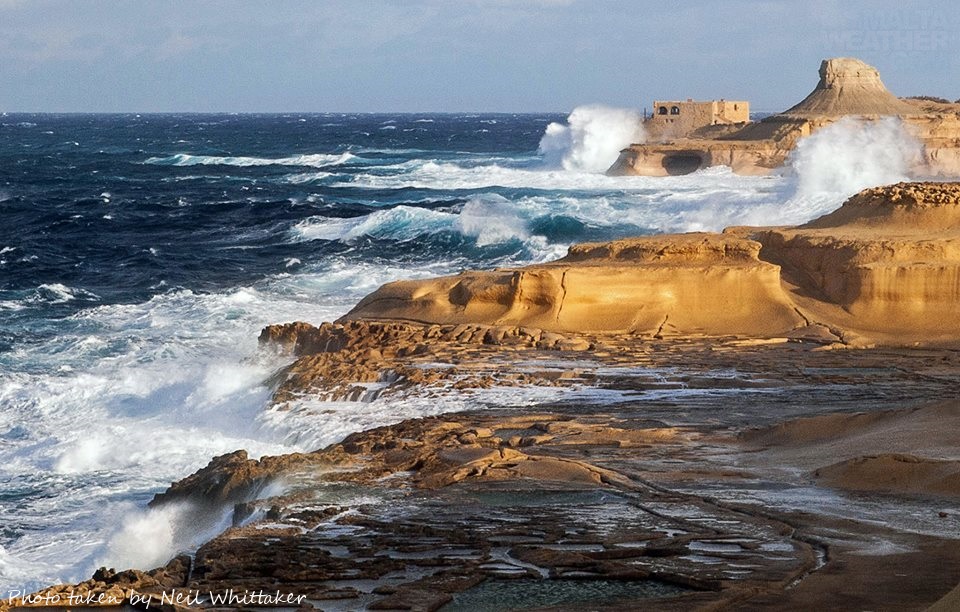
Worst effected will be locations and hilltops exposed to northwesterly winds, including Marsalforn and Dwejra in Gozo, and along the northwestern coast of Malta including Ċirkewwa, Paradise Bay, Golden Bay, Għajn Tuffieħa Bay and Ġnejna Bay. The Gozo Channel ferry service is NOT expected to be disrupted.
MaltaWeatherSite provides detailed weather forecasts including a detailed 7-day marine weather forecast, a live weather webcam and a hazardous weather outlook for the next 7 days on www.maltaweathersite.com.
And a big thanks to Neil Whittaker for this pic taken at Xwejni Bay in Gozo a few days ago.
Issued at 4pm on Monday 27th January 2014
Leave a Reply
You must be logged in to post a comment.