
 GALE WATCH – please LIKE & SHARE for others too. Thanks.
The contrast between a low pressure system moving southeastwards across the Balkans and an area of high pressure over northern Africa will create a strong airflow over the Maltese Islands tomorrow Wednesday.
The wind is expected to reach Force 7, occasionally Force 8, from a northwesterly direction from around noon tomorrow Wednesday till 3am on Thursday. Maximum significant wave heights of around 4 metres from a northwesterly direction are expected by late tomorrow Wednesday. Swell heights are expected to be around 1.6 metres on Thursday.
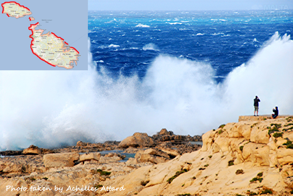
This will DEFINITELY be dangerous for small boats or swimming so do NOT go out in a small boat or swimming at the following locations tomorrow Wednesday and on Thursday. The red lines on the small map at the top left of this image also indicate the affected coastal areas:
Malta: Fomm ir-Riħ Bay, Ġnejna Bay, Għajn Tuffieħa Bay, Golden Bay, Anchor Bay, Paradise Bay, Ramla tal-Bir Bay, Ramla tal-Qortin Bay, Qawra, Qalet Marku, White Rocks, Pembroke, Sliema and Xgħajra. It is also NOT advised to swim at Għar Lapsi and Wied iż-Żurrieq.
Gozo: Dwejra Bay, Xwejni Bay, Qbajjar Bay, Marsalforn Bay, Ramla l-Ħamra Bay, San Blas Bay and the outer parts of Xlendi Bay.
The Gozo ferry service should NOT be disrupted.
Please LIKE & SHARE for others. Thanks.
The weather today will be with increasing high clouds. Tomorrow the weather will be mostly cloudy with possibly some light rain in places. Temperatures will go down to 22°C tonight and up to 27°C tomorrow, although this will feel cooler because of the strong wind.
MaltaWeatherSite provides detailed weather forecasts including a detailed 7-day marine weather forecast, a live weather webcam and a hazardous weather outlook for the next 7 days on www.maltaweathersite.com.
A big thanks to Achille Attard for this pic taken at Dwejra Bay in Gozo.
Leave a Reply
You must be logged in to post a comment.